Los Glaciares Argentine National Park is the first declared a World Heritage for its incredible natural beauty, scientific interest and its fauna in danger of extinction.
It is located in the southwest of the province of Santa Cruz, has a total area of 726,927 hectares, where there are spectacular mountains, lakes and forests, including the west a wide region of the Andes Mountains covered with ice and snow and to the east, the arid Argentine Patagonian steppe.
The name of the park is due to the presence of numerous glaciers, these ice giants in frozen rivers are giving shape to beautiful silhouettes with varied shapes that resemble dikes, caves or bridges as they move forward and backward. It is important to note that within the park is the largest ice sheet in the world after Antarctica, occupying half of its surface. The presence of 47 large glaciers that originate in the great Patagonian Continental Ice Field, of which 13 descend towards the Atlantic basin. There are also more than 200 smaller glaciers that are independent of the Patagonian Ice Field.
As a result of the thawing of this immense system, two large lakes originate: Lake Argentino and Lake Viedma, which discharge their waters into the Atlantic Ocean crossing the entire province through the Santa Cruz river.
World Heritage
Unesco declared to Los Glaciares Argentine National Park a World Heritage Site in 1981 due to its incredible natural beauty, the glaciological and geomorphological scientific interest, as well as the species of its fauna that the park has and that they are in danger of extinction.
World Heritage is the title conferred by Unesco (United Nations Educational, Scientific and Cultural Organization) to specific sites on the planet. The program has the objective of cataloging, preserving and publicizing sites of exceptional cultural or natural importance for the common heritage of humanity. Furthermore, on certain occasions and subject to certain conditions, sites can obtain funding for their conservation from the World Heritage Conservation Fund. Some examples include the pyramids of Giza in Egypt, Machu Picchu in Peru or the Himeji Castle (Himeji-jo) in Himeji, Japan.
A bit of history
The mission of the National Park is to preserve the area of continental ice and glaciers, together with the southern Andean-Patagonian forest and parts of the Patagonian steppe. It is the largest park in the National System of Argentine Protected Areas.
On February 15, 1877, the Argentinean expert for boundary questions, Francisco Pascasio Moreno, planted the Argentine flag and gave the name to Lake Argentino, coming very close to the glacier that Later it would bear his name, but he did not get to know him, although he was one of the first people to visit the area.

Creation of Los Glaciares National Park
In 1937, through decree No. 105,433, Argentine President Agustín Pedro Justo established the status of reserves in 4 Patagonian territories, including the Los Glaciares National Reserve. Years later, in September 1942, the coastal margin of the Reserve was extended over the Canal de los Témpanos and the north coast of Lake Rico and then in April 1945, Decree Law No. 9504, ratified by Law No. 13,895, and Several reserves were declared a National Park, including Los Glaciares. In 1971, through Law No. 19,292, the boundaries of the park were demarcated, in addition to its zoning as a national park and national reserve.
Administrative management
The National Parks Administration in May 2011 ordered that the national park be classified for administrative purposes in the category protected areas of complexity, the management of the park is in charge of a designated mayor, on which 6 administrative departments depend and is based in the town of El Calafate, in addition more in El Chaltén there is an information center.
According to what is established in a management plan, the surface area of Los Glaciares National Park is subdivided into two areas: the national park with 538,550 ha, and the protected area with managed resources with 188,377 ha. which, in turn, is sub-divided into three zones called national reserves: Zona Viedma, Zona Centro, and Zona Roca.
The western limits follow the Chilean-Argentine international dividing line at all times between parallels 49 ° 15 ‘and 50 ° 50’ South, from Cerro Chaltén to Mount Stokes according to the demarcation resulting from the Agreement signed on December 16, 1998, although the Mariano Moreno cordon sector has yet to be demarcated.

The National Park includes part of the field of the Continental Patagonian Ice and all the glaciers that descend towards the Atlantic. In addition to Los Glaciares National Park, there are two provincial protected areas within its limits which are: the provincial park and the Peninsula de Magallanes provincial reserve and the Lago del Desierto provincial reserve.
Entry hours to Los Glaciares National Park:
From September 1 to April 30, 08: to 18:00
From May 1 to August 31 from 09:00 to 16:00
During the hours in which the payment is not made, the Access Portal remains closed and with security personnel.
Places to visit and activities
- Trekking on the ice, sailing, hiking, climbing, fishing, are some of the options offered by the Park and allow to know places such as: </ li>
- Perito Moreno, Upsala and Spegazzini Glaciers.
- Lago Roca.
- Patagonian Ice Field.
- Lago del Desierto -37 km from El Chaltén, by RP 23-. You can camp and practice sport fishing.
- Cerro Chaltén or Fitz Roy area.
- Viedma Glacier
- Chorrillo del Salto
Recommendations to visit the National Park
- The indications of the park ranger who is the authority of the area must be respected.
- Trash must be disposed of outside the National Park. It is forbidden to throw waste.
- You must not leave traces of your visit.
- As in all protected areas, pets are not allowed.
- The use of drones is prohibited.
- The status of routes and trails must be verified. In winter, due to the presence of snow, the use of covers with nails or chains is mandatory.
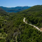
- You must drive slowly, with caution for the safety of other visitors and respect traffic rules and signs.
- You must find out in which sectors of the National Park camping is allowed.
- To avoid falls, use footwear suitable for trekking, both for nature trails and for walking the Perito Moreno Glacier walkway circuit since the floor It is made up of a system of metal grids.
- Fishing is regulated and must be carried out with the corresponding permit.
- You can only make a fire in the enabled stoves and you must bring firewood to use.
- Climbers must register with the Park Information Center.
- Walk on the enabled trails.
- It is not allowed to make fire with wood. The use of heaters is allowed only in camping areas.
- In winter season (from May to September) it is necessary to register at the Park Information Center to walk the trails and also to camp in camps enabled and remote areas.

Available services
There is a very large hotel and gastronomic offer in the towns of El Calafate and El Chaltén and in the service stations. Los Glaciares National Park has a camp organized at Camping Lago Roca and a free one, El Huala in Lago Roca, and there is also an area specially prepared for picnics on the Miter River on the way to the Perito Moreno Glacier. In addition, on the trails in the north there are sectors where free camping is allowed in El Chaltén such as: Poincenot, Río Blanco, De Agostini, Laguna Capri, Toro. It is also very common for many estancias to offer tourism services, both within the protected area and in its surroundings.
Transport
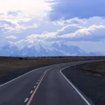
By car:
- From El Calafate by RP 11 to the Perito Moreno Glacier (80 km of route).
- RP 11 and RP 8 up to Puerto Bandera (47 km).
- Lago Roca (50 km) can be accessed by the RP 11 towards the Moreno Glacier, turning left on the RP 60 (gravel road) until connecting with the RP Nº 15 or, always traveling the RP 15 gravel road.
- RP 11, RN 40 and RP 41 to El Chaltén (220 km of pavement).
Other options: From the El Calafate international airport there is a connection by bus with the capital of the province of Santa Cruz, Río Gallegos. There are also car rental companies, and you can hire excursions and use the daily bus services to El Chaltén in the north of the park, to Lake Roca or to the Perito Moreno Glacier.
Unique characteristics of Los Glaciares National Park
In general terms, other glaciers in different parts of the world are usually at 2500 meters above sea level (masl), however the glaciers of Argentine Patagonia have their origin at only 1500 meters above sea level and descend to 200 meters above sea level, providing easy access and a unique view.
Continental ice occupies an approximate area of 2,600 km², it is say that more than 30% of the surface of the park is covered by ice.
Los Glaciares National Park is located between the Patagonian forest region and the Patagonian steppe and its name is due to the numerous glaciers that make up the majestic landscape of the Cordillera de the Andes in its southern region.
The landslides of the large blocks of ice are impressive and attract many tourists from different parts of the world, in a unique natural setting are the large blocks of glacial ice between mountains and forests . In addition, the landscape is complemented by melt lakes and rivers, lagoons, and the imposing Fitz Roy and Torre hills. The imposing Perito Moreno glacier stands out, which is known worldwide due to its ease of access and the majestic spectacle of rupture.
Perito Moreno Glacier

The Perito Moreno Glacier
In the southern area of the National Park and near the town of El Calafate, you can find the most famous glacier and visited by tourists from all over the world. The Perito Moreno Glacier produces a cyclical phenomenon of advance and retreat that is a continuous movement that produces the impressive landslides on its ice front that cause a unique natural spectacle. </ span >
Mount Fitz Roy

At the northern end of the Park near the small town of El Chaltén are the highest granite-shaped peaks and the greatest diversity of the Andes mountain range, the Mount Fitz Roy (3405m) and Cerro Torre (3102m) attract numerous mountaineers and trekking enthusiasts from all over the world.
Weather
The weather is mild to cold and humid. Average temperatures range from 0.6 ° C in winter to 13.4 ° C in summer, for the lower areas and in the higher altitude areas the average annual temperature reaches -3 ° C. The average rainfall is 500 to 900 mm per year, from east to west, distributed throughout the year. During the colder months there is abundant snowfall and the strongest winds blow in summer.
The ideal season to visit the Los Glaciares National Park area is during spring and summer in the southern hemisphere, but also in early autumn (September-April).
According to research in archaeological sites, it is known that the Lake Argentino region was occupied by hunter-gatherer groups that had a wide mobility to take advantage of the spaces in the steppe as in the forest, at heights from 200 to 1100 meters above sea level. The economy, centralized in the exploitation of the guanaco. Materials from the Pacific Ocean were also found, which would imply access to those areas or the existence of exchange.
Animals and nature
The main specimens of its flora are trees of the genus Nothofagus el ñire and lenga, the guindo or coihue de Magallanes, on the other hand within the conifers is the cypress of the guaitecas (Pilgerodendron uviferum).
The presence of a very tasty fruit bush called calafate that blooms in the months of November and December is important, and is widely used in other places in Patagonia, such as Ushuaia, to make sweets and liqueurs. In the sector of the park that corresponds to the steppe, bushes such as neneo, paramela, mata negra, llareta, senecio and grasses such as coirones species, the plum or notro with very colorful flowers predominate.

The forest has the presence of the puma and the huemul that during the winter come down from the high grasslands in search of food, in the steppe areas there are guanacos and there are also the called bighorn cows, introduced in the late 19th century.
To the east, the foothills of the Andes fade into the Patagonian plateau and the forest gives way to the steppe. Guanacos, gray foxes and Patagonian skunks and maras live here. Among the birds, the great corridor of the area stands out, the short choique or ñandú.
A great diversity of birds is found, including black-necked swans and ducks such as the great diver and the torrent diver. In high altitude areas you can find the choique and the condor, as well as in the forests, the Patagonian black woodpecker, the southern parrot, the garnet-crowned hummingbird.

Huemul
Hours and more information for Access to the National Park
Only the Mitre-Cerro Moreno Corridor has access hours: Summer: From September 1 to April 30 from 8 AM to 6 PM (with stay until 8 PM). Winter: From May 1 to August 31 from 9 AM to 4 PM (with stay until 6 PM). A promotional pass with a 50% discount for the second visit to the Park can be purchased through this sales site of APN.