Best Trekking Routes in Patagonia: Ultimate Guide with Maps, Photos & Expert Tips
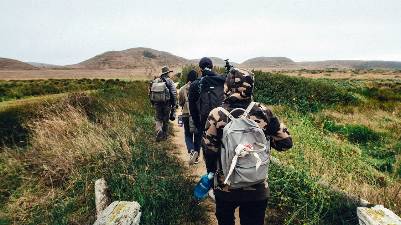
Patagonia is a trekker’s paradise, renowned for its dramatic landscapes, iconic peaks, and pristine wilderness. Whether you’re a seasoned hiker or a passionate beginner, these are the best trekking routes in Patagonia—complete with detailed trail info, interactive maps, stunning images, and insider tips.
| Trek Name | Distance | Duration | Difficulty | Best For |
|---|---|---|---|---|
| Torres del Paine W | 80 km | 4–5 days | Moderate | Iconic scenery |
| O Circuit (Torres del Paine) | 110 km | 7–10 days | Difficult | Full park circuit |
| Fitz Roy (El Chaltén) | 24 km | 1 day | Moderate | Day hike, panoramic views |
| Huemul Circuit | 65 km | 4 days | Challenging | Experienced trekkers |
| Dientes de Navarino | 53 km | 4–5 days | Difficult | Off-the-beaten-path |
To deliver truly valuable and in-depth information, this guide offers granular insights into each trekking route, essential for establishing it as an authoritative and indispensable resource for anyone planning a Patagonia trekking adventure. Below is a quick glance at some of Patagonia’s premier treks:
| Trek Name | Location | Distance | Typical Duration | Difficulty | Best Season | Key Highlight/Challenge |
|---|---|---|---|---|---|---|
| Torres del Paine: W Trek | Torres del Paine National Park, Chile | 76 km (47 miles) | 4-6 days | Moderate | Dec-Feb | Iconic granite spires, unpredictable weather |
| Torres del Paine: O Circuit | Torres del Paine National Park, Chile | 120-126 km (75-78 miles) | 8-11 days | Strenuous | Dec-Feb | Backside solitude, John Gardner Pass, rigorous booking |
| Fitz Roy Trek | Los Glaciares National Park, Argentina | 21 km (13 miles) | 1-2 days | Moderate | Nov-Mar | Iconic Fitz Roy views, self-sufficiency |
| Huemul Circuit | Los Glaciares National Park, Argentina | 65 km (40 miles) | 4 days | Demanding | Nov-Mar | Tyrolean traverses, Viedma Glacier, unmarked trails |
| Dientes de Navarino Trek | Isla Navarino, Chile | 53 km (33 miles) | 5-7 days | Demanding | Dec-Mar | Southernmost trek, extreme weather, remote |
| Cerro Castillo Circuit | Cerro Castillo National Park, Chile | 49-51 km (30-32 miles) | 3-5 days | Demanding | Dec-Mar | Undervalued beauty, river crossings, steep passes |
| Perito Moreno Glacier Ice Trek | Los Glaciares National Park, Argentina | Varies | 0.5-1 day | Moderate | Sep-Apr | Walking on ice, crampons, age/health restrictions |
1. Torres del Paine W Trek & O Circuit
- Distance: 80 km (W Trek), 110-126 km (O Circuit)
- Duration: 4–5 days (W Trek), 7–10 days (O Circuit)
- Difficulty: Moderate (W Trek), Difficult/Strenuous (O Circuit)
- Elevation Gain: ~2,500 m total (W Trek), ~5,060 m total (O Circuit)
- Best Season: November–March
- Highlights: The Towers, French Valley, Grey Glacier, Lake Pehoé (W Trek); John Garner Pass, remote valleys, full park circuit, greater solitude (O Circuit)
- Permit: Required (book in advance)
Torres del Paine National Park, located in Chilean Patagonia, is celebrated for its dramatic granite peaks, vibrant turquoise lakes, and colossal glaciers. It is home to two of the region’s most iconic treks: the W Trek, a classic and highly popular route, and the O Circuit, a more extensive and physically demanding full loop around the Paine Massif. The O Circuit encompasses the W Trek while adding more remote valleys, wild glaciers, alpine passes, and a greater sense of solitude.

Logistics
The primary gateway to Torres del Paine is Puerto Natales, a town in southern Chile. Regular bus services connect Puerto Natales to Laguna Amarga, a main park entrance. From Laguna Amarga, a shuttle typically transports trekkers to Refugio Central, a common starting point for the W Trek. For those opting to begin on the western side of the park, a catamaran service is available from Pudeto to Paine Grande. The W Trek typically spans 4 to 6 days. A representative 6-day itinerary might involve hiking from Central to Chileno on Day 1, an optional sunrise hike to Base Torres and return to Central on Day 2, proceeding to Cuernos on Day 3, then to Paine Grande on Day 4, continuing to Grey on Day 5, and finally returning from Grey to Paine Grande before taking the ferry to Pudeto and a bus back to Puerto Natales on Day 6. Trekkers have the flexibility to choose between East-to-West or West-to-East directions. Accommodation options along the W Trek include mountain huts (refugios) with shared bunk rooms or designated campsites. These facilities are managed by two distinct private companies: Las Torres Patagonia (formerly Fantástico Sur) oversees sites such as Central, Francés, Cuernos, and Chileno, while Vértice Patagonia manages Paine Grande and Grey. Trekkers can pre-book full board (breakfast, box lunch, dinner) or half board options, which must be reserved in advance.
The O Circuit is an 8-day, 7-night trek, covering approximately 120 kilometers (74.5 miles) with a cumulative elevation gain of 5,060 meters. Some sources indicate it can range from 6 to 11 days and covers 123 kilometers (76 miles). It is generally classified as moderate to strenuous. Access mirrors that of the W Trek, primarily from Puerto Natales via bus to Laguna Amarga and shuttle to Hotel Las Torres. The catamaran across Lake Pehoé is also relevant for certain itinerary variations. A critical logistical requirement is that the backside of the O Circuit (the “O” portion) must be hiked in a counter-clockwise direction, a park regulation designed to manage traffic flow and ensure safety. A typical 8-day itinerary includes segments such as Central to Serón, Serón to Dickson, Dickson to Los Perros, Los Perros to Grey, Grey to Paine Grande, Paine Grande to Cuernos via Mirador Británico, Cuernos to Chileno, and Chileno back to Central via Las Torres. Accommodation options are similar to the W Trek, offering basic tent platforms (requiring personal gear), pre-assembled tents with rental equipment (sleeping bag/mat), or refugio accommodation (though not available at all campsites). Reservations are split between Las Torres Patagonia and Vértice Patagonia.
Challenges
Patagonia’s weather is notoriously unpredictable. Trekkers must be prepared for strong winds, which can reach speeds of up to 100 mph (180 kph), along with rain and even snow, all potentially occurring within the same day, even during the summer months. The wind chill factor can make the ambient temperature feel significantly colder. Securing reservations for both park entry and campsite/refugio accommodation is critically important and must be completed months in advance, particularly for the peak season from December to February. Park rangers strictly enforce this policy and will not permit entry onto the O side of the trek without proof of pre-booked lodging. High-demand camps, notably Chileno and Cuernos, sell out rapidly. Both treks, especially the O Circuit, involve long hiking days, substantial elevation gains, steep inclines, and challenging terrain such as boulder fields. The John Gardner Pass on the O Circuit, the highest point of the trek, is particularly known for heavy winds and a steep descent. While water is generally abundant and safe to drink directly from streams and glacier-fed rivers, food purchased within the park at campsites and refugios can be expensive. Packing one’s own freeze-dried meals presents a significantly more economical alternative. Although trails are generally well-marked, the more remote backside of the O Circuit, particularly between Serón and Grey, can present navigational challenges, especially if snow is present on the route to Paso John Gardner. The use of offline maps (e.g., Maps.me) is highly recommended. Connectivity is limited, with cell service being spotty to non-existent on the trails, and internet signal generally unavailable.

Booking
Entrance tickets to Torres del Paine National Park are mandatory and must be purchased online in advance via the official CONAF website (pasesparques.cl). Purchasing tickets at the park entrance is generally not a viable option for those arriving by bus or in groups due to potentially long queues and a limited number of self-service totems. Fees vary based on nationality, age, and duration of stay. Campsite and refugio reservations must be made separately through the websites of Las Torres Patagonia (lastorres.com/en/) and Vértice Patagonia. Bookings typically open between June and September for the subsequent season. For adult foreign nationals staying more than 3 days, the park fee is approximately CLP 46,200 (US$50). Campsite platforms average around US$28 per person per night, or US$45 for solo campers. Refugio dorm beds can range from US$43 to US$180 per night. Full board meal plans cost approximately US$95-130, while half board is US$65-90. The mandatory advance booking system and tiered pricing structure in Torres del Paine create a situation where convenience, such as pre-booked meals or rented gear, and the inability to plan far in advance, such as last-minute bookings, incur a substantial financial surcharge. This effectively represents a “Patagonia Tax” for those seeking ease or flexibility. Conversely, trekkers who plan meticulously, book well in advance, and are prepared to carry their own gear and food can significantly reduce their overall costs, demonstrating that preparedness and self-sufficiency offer substantial financial benefits in this highly popular park.
Best Season
The Southern Hemisphere summer, from November to March, is generally considered the most favorable time for hiking in Torres del Paine. December to February constitutes the peak season, offering the longest daylight hours (up to 17 hours) and warmest temperatures, though it also brings the strongest winds and highest crowds. Shoulder months, specifically November and March, present attractive alternatives due to fewer crowds, less intense winds, and cooler temperatures.

Gear
Essential gear includes sturdy hiking boots, trekking poles (highly recommended for stability in strong winds and on varied terrain), a full waterproof shell, warm base layers, a down jacket, gloves, and a beanie. For unsupported treks, a durable four-season tent is crucial. Gear rental options are available in Puerto Natales.
Official Park Information
For official information and booking, visit the CONAF website or the Torres del Paine official tourism site.
Tip: Book refugios/campsites early. Weather changes rapidly—bring layers and waterproof gear.
Expect steep ascents and descents, which are rewarded with some of the most secluded and awe-inspiring vistas in the park. The John Garner Pass is one such highlight, offering a thrilling panoramic view of the Southern Patagonian Ice Field. This trek demands thorough preparation and a good level of fitness, but for those who complete it, the sense of accomplishment is unparalleled.
2. Fitz Roy Trekking in El Chaltén
- Distance: 24 km (round trip)
- Duration: 1 day
- Difficulty: Moderate
- Elevation Gain: 750 m
- Best Season: October–April
- Highlights: Laguna de los Tres, Mount Fitz Roy, Patagonian forests
- Permit: Not required
This trek is a bit shorter but no less stunning. It’ll take you past picturesque lagoons, lush forests, and striking ridgelines. The highlight is the viewpoint at Laguna de los Tres, which offers an incredible perspective of Mount Fitz Roy and its surrounding peaks.

Logistics
The trek spans approximately 21 kilometers (13 miles) round-trip and is rated as “Moderate” in difficulty. It can be completed as a challenging single-day hike, typically requiring 8-10 hours round-trip, or extended into a 1-2 day trip by camping along the route. The trek commences directly from El Chaltén, Argentina, often referred to as the “Argentine Capital of Trekking”. The trailhead is conveniently situated within a short walking distance from the town center. To reach El Chaltén, most travelers first fly into El Calafate, a larger town with an airport serving as the primary gateway to the region. Regular bus services operate between El Calafate and El Chaltén, with the journey lasting approximately 3 hours. Renting a car provides greater flexibility for exploring the broader Patagonian region at one’s own pace. The trek offers free, designated campsites, primarily Campamento Poincenot and Campamento Capri. Campamento Poincenot is the most popular, located closer to Laguna de los Tres within a sheltered forest, offering protection from the wind. Campamento Capri, while slightly further from the main viewpoint, serves as a suitable alternative for a shorter first-day hike. It is crucial to note that these campsites are basic, offering no services, which means trekkers must be entirely self-sufficient. Water is abundant along the trail, sourced from numerous streams and rivers fed by glacial melt. While many hikers drink directly from these sources, carrying a water filter or purification tablets is recommended for safety.
Challenges
The most challenging section of the Fitz Roy Trek is the final 1-kilometer (0.6-mile) ascent from Campamento Poincenot to Laguna de los Tres. This segment involves a steep climb of 400 meters (1,312 feet). The trail in this area can be rocky and exposed, necessitating a slow and deliberate pace, particularly for those hiking before sunrise to witness the iconic views. Patagonia’s weather is notoriously unpredictable. Trekkers should be prepared for sudden and drastic changes, including strong winds, rain, and cold temperatures, even during the summer months. Dressing in layers is essential to adapt to these rapidly changing conditions. During the peak summer months, popular free campsites like Campamento Poincenot can fill up quickly, making early arrival advisable to secure a spot if camping is planned.
Booking
No permits are required to hike or camp on the Fitz Roy Trek. However, it is strongly recommended that trekkers register at the ranger station in El Chaltén before commencing their journey. This registration allows park authorities to track hikers for safety purposes. Unlike Torres del Paine, where permits and bookings are mandatory and strictly enforced, the Fitz Roy Trek operates on a model where access to the wilderness is largely unrestricted. Campsites are free but provide no services, meaning hikers are solely responsible for their gear, food, and water. While not a formal permit, registration at the ranger station is advised, indicating a system of monitoring rather than strict access control. This model reflects a philosophy where the onus of preparedness, safety, and adherence to “Leave No Trace” principles falls entirely on the individual hiker. This contrasts sharply with the managed, reservation-heavy system of Torres del Paine, suggesting differing approaches to conservation and tourism, potentially reflecting the varying levels of infrastructure and visitor numbers in each park. This approach attracts a demographic of trekkers who prioritize independence and self-reliance.
Best Season
The optimal time to hike the Fitz Roy Trek is during the Southern Hemisphere summer, from November to March. This period offers the most favorable weather conditions and extended daylight hours.
Gear
Essential gear includes appropriate layers for variable weather, a map or GPS device, and potentially a water filter or purification tablets. For those planning to camp, a full backpacking setup, including a tent, sleeping bag, stove, and food, is necessary.
Official Park Information
For official information on Los Glaciares National Park, visit the Argentina National Parks website.
Tip: Start early for sunrise at Laguna de los Tres. Bring windproof clothing and plenty of water.
3. Huemul Circuit
- Distance: 65 km
- Duration: 4 days
- Difficulty: Challenging/Demanding
- Elevation Gain: 2,500 m
- Best Season: December–March
- Highlights: Viedma Glacier, Paso del Viento, remote wilderness
- Permit: Required (register at El Chaltén ranger station)
The circuit leads you into remote areas where you’ll see glaciers, broad valleys, and the Viedma Glacier with its stunning blue ice. Note that this trek involves some river crossings and steep climbs, so being well-prepared and potentially hiring a guide are advisable precautions.

Logistics
The circuit typically takes 4 days to complete, covering about 65 kilometers (40 miles), and is consistently rated as demanding or medium to heavy difficulty. The trek commences directly from El Chaltén. A distinctive feature of the Huemul Circuit is the requirement for two Tyrolean traverses across the Túnel River using a zipline, as there are no bridges over the deep gorge. This is a significant logistical element that requires specific gear and technical proficiency. The circuit involves remote wild campsites, where trekkers are expected to be entirely self-sufficient for food and gear.
Challenges
The Huemul Circuit is described as a “demanding trekking route” aimed at experienced trekkers with a very high level of fitness. The terrain is varied and challenging, including uneven and rocky moraine, steep descents, and often unpredictable paths. The rocky moraines can be particularly taxing on the knees, making trekking poles highly recommended. The Tyrolean traverses over the Túnel River are a significant and thrilling challenge. Trekkers must be prepared for a wide range of harsh weather conditions, including strong winds, especially at the two main passes (Paso del Viento and Paso Huemul), and potential snow at lower altitudes even during spring and autumn. The Paso del Viento, or “Windy Pass,” lives up to its name, with famously wild Patagonian winds that can make the climb exceptionally challenging, requiring hikers to lean into the wind with heavy packs and trekking poles. Hikers are expected to carry a heavy rucksack, typically 55-65 liters in capacity, containing camping equipment, food, and clothing, adding around 9-11 lbs (4-5 kg) of weight. For much of the circuit, the trail is completely unmarked. While experienced trekkers may attempt it self-guiding with a map and GPS, undertaking the trek with an experienced guide is strongly advised due to its remote and challenging aspects, including the Tyrolean traverse, glacier crossing, and unpredictable weather. The three campsites (Laguna Toro, Paso del Viento, and Bahía de los Témpanos) are basic, offering only simple shelters for meals and long-drop toilets, with no showers. Unless on an organized trek, trekkers must be entirely self-sufficient for food, and a camping stove is mandatory as campfires are prohibited. Water is sourced from glacial-fed streams. The trek operates on a strict “Leave no trace” principle, requiring all waste to be carried out.

Booking
No formal permits are required for the Huemul Circuit; however, trekkers must sign in with park rangers in El Chaltén before setting out and sign out upon return. If a trekker is not back within two days of their stated return, a search will be initiated. Specific requirements from park rangers include sufficient mountain experience and the possession of a harness and two carabiners (one steel, one aluminum) for the rope slides across rivers. These items can be rented from outdoor stores in El Chaltén. As there is no network coverage on the trail, carrying a satellite phone is advisable, especially for solo travelers, and these can be borrowed from the park ranger station. It is also crucial to check weather conditions carefully before departure, as strong winds can make the trail impassable, sometimes requiring a wait of several days for conditions to improve. The Huemul Circuit, unlike the more managed treks in Torres del Paine, operates under a philosophy of “unfiltered wilderness” where access is granted with minimal formal requirements, but with significant implicit demands on the trekker. The absence of mandatory permits or pre-booked accommodations, coupled with the requirement for self-sufficiency and technical gear for river crossings, creates a natural filter that attracts only the most prepared and experienced adventurers. This approach preserves the raw, untamed character of the landscape, ensuring that the “solitude” and “wild glaciers” mentioned in the outline are genuinely experienced. This contrasts with more regulated parks, suggesting a deliberate choice to maintain a higher barrier to entry, thereby protecting the delicate ecosystem and the pristine nature of the trekking experience from mass tourism.
Best Season
The Huemul Circuit is best undertaken during the Southern Hemisphere summer, from November to March.
Gear
Essential gear includes a 50-60 liter rucksack for personal gear, a sleeping bag rated for 10°F (-12°C), an inflatable sleeping mat, and appropriate clothing for four seasons in a single day (windproof and waterproof jacket, warm layers, warm hat, neck gaiter, windproof gloves). Waterproof hiking boots that support the ankles are essential, along with sandals for river crossings. Trekking poles are strongly recommended. A camping stove is mandatory, as campfires are prohibited.
Official Park Information
For official information on Los Glaciares National Park, visit the Argentina National Parks website.
Tip: For experienced trekkers only. River crossings and strong winds are common—bring a harness and rope for safety.
4. Dientes de Navarino Trekking
- Distance: 53 km
- Duration: 4–5 days
- Difficulty: Difficult/Demanding
- Elevation Gain: 2,000 m
- Best Season: December–March
- Highlights: Dientes peaks, Lago Windhond, southernmost trek in the world
- Permit: Not required
This trek takes you through diverse landscapes, including windswept peaks, serene lakes, and old-growth forests. The sense of isolation and adventure is heightened by the raw, untamed beauty of the area.

Logistics
The Dientes de Navarino Trek is typically a 5-day guided trek, though some itineraries may extend to 7 days. The tour generally includes pickup at accommodation or the airport in Puerto Williams, with round-trip shared transport provided. Some guided tours include domestic flights between Punta Arenas and Puerto Williams, or offer an alternative boat ride between Puerto Williams and Ushuaia. A typical 5-day itinerary involves: Day 1: Puerto Williams to El Salto Lagoon (5 hours, ascending Cerro Bandera for panoramic views); Day 2: El Salto Lagoon to Escondida Lagoon (6-7 hours, crossing Primero, Australia, and Los Dientes Passes); Day 3: Escondida Lagoon to Martillo Lagoon (5-6 hours, traversing Guerrico Pass); Day 4: Martillo Lagoon to Guanacos Lagoon (7 hours, reaching Virginia Pass); Day 5: Guanacos Lagoon back to Puerto Williams (5.5 hours, descending through forests). Accommodation is typically in tents for multiple nights. Meals (breakfast, lunch, dinner) are often included in guided packages.
Challenges
The weather in the Dientes de Navarino Mountains is highly unpredictable, especially from Los Dientes Pass onwards, necessitating strict safety precautions even after camp is established. The section through Virginia Pass is particularly hazardous, involving walking on an unstable snow ledge over a 300-meter cliff, demanding extreme caution and strict adherence to guide instructions. The wind in this area is also exceptionally strong. Cell phone reception is generally non-existent throughout most of the circuit, with signal only available at specific points, typically at the start and end. Similarly, internet access is unavailable. There is no electricity for charging electronic devices, making a power bank essential. Due to the physical demands and operational insurance requirements, the trek is not suitable for pregnant women, and a minimum age of 14 years is typically enforced. Participants are expected to carry their own backpack, weighing 10-13 kg (22-29 lbs), which includes personal items, a camping mat, a sleeping bag, and packed lunches for trekking days. Basic comforts such as dining/cooking tents, showers, and toilets should not be expected on this wilderness trek. The Dientes de Navarino trek, as the world’s southernmost, presents an extreme environment that necessitates extreme preparation. The consistent emphasis on unpredictable weather, treacherous terrain like unstable snow ledges, and the complete lack of modern connectivity highlights that this is not merely a challenging hike but an expedition into one of the planet’s most isolated and unforgiving landscapes. The strict age and health restrictions, coupled with the explicit mention of carrying a satellite phone for emergencies, underscore the inherent risks and the high level of self-reliance and physical resilience required. This trek attracts a very specific type of adventurer who actively seeks out the raw, untamed aspects of nature, understanding that the reward of unparalleled solitude and unique geographical perspectives comes with uncompromising demands on preparedness and physical capability.
Booking
A minimum of 2 participants is typically required to confirm the service for guided tours. Bookings are generally accepted up to 7 days in advance for some services, but early booking is highly recommended due to limited availability. Payment methods vary, but online payment is common. Cancellation policies are strict, with no refunds or reschedules for cancellations within 21 days of the start date, regardless of the reason, making travel insurance highly advisable. A solo traveler supplement may apply if no other passengers are confirmed for a desired departure date.
Best Season
The best season for the Dientes de Navarino trek is from December to March.
Gear
Essential gear includes a waterproof jacket and pants, polar warm clothes (e.g., Polartec), thermal base layers, short and long-sleeved T-shirts, trekking shoes, a power bank, earplugs, sandals for resting, a towel, a liner, a headlamp, and a winter hat and gloves. Hikers must carry their own backpack (50-60 liters) with personal items, a camping mat, and a sleeping bag. Guided tours typically provide expedition tents and cooking equipment, with local porters carrying these items.
Official Tourism Information
For general tourism information about Puerto Williams and Isla Navarino, visit the La Ruta de los Parques website.
Tip: Navigation can be tricky—carry a GPS device. Weather is unpredictable and often harsh.
5. Cerro Castillo Circuit
- Distance: 49-51 km (30-32 miles)
- Duration: 3-5 days
- Difficulty: Demanding
- Elevation Gain: +2,309 m (7,577 ft) ascent, -2,786 m (9,139 ft) descent
- Best Season: December–March
- Highlights: Craggy mountain vistas, glaciers, turquoise lakes, less crowded wilderness
- Permit: Required (register at CONAF office)
The Cerro Castillo Circuit, located within Cerro Castillo National Park in Chile’s Aysen region, is a multi-day trek that takes adventurers deep into a less-crowded wilderness of craggy mountain vistas, glaciers, and turquoise lakes. It is often considered a great alternative to the more popular Torres del Paine.

Logistics
The Cerro Castillo Circuit typically spans 3 to 5 days, covering a distance of 49-51 kilometers (30-32 miles). It is rated as demanding. The trek traditionally starts outside the park boundaries, following an old logging road until reaching the CONAF office at Las Horquetas, the official trailhead where trekkers sign in. The route involves several river crossings, where trekkers should expect to get wet. A common 4-day itinerary includes: Day 1: Las Horquetas to Camp Turbio (17 km, 400m ascent); Day 2: Camp Turbio to Camp Bosque (12 km, 887m ascent to Peñon Pass); Day 3: Camp Bosque to Camp Porteadores (9 km, 1136m ascent to Morro Negro Pass, passing Lake Cerro Castillo); Day 4: Camp Porteadores to La Casona (10 km, with a diversion to Camp Neozelandes and Laguna Duff before descent). This is primarily a backpacking tour, requiring participants to bring their own tent, sleeping pad, and sleeping bag, as campsites are designated but basic. Water is sourced from glacial-fed streams.
Challenges
The trek requires a good level of physical fitness and is ideally suited for those with prior multi-day trekking experience. Participants must be prepared to carry a heavy rucksack over changeable and often rocky terrain in various weather conditions. The second and third days involve significant elevation gains and steep climbs, including the Peñon Pass (1300m a.s.l.) and the Morro Negro Pass (1700m a.s.l.), the latter being the steepest climb of the trek. Snow can be present at the Peñon Pass even late into the season, and the descent from Morro Negro Pass is sharp and often on loose scree. Patagonia’s harsh environment is characterized by extremely high winds and rapidly changing weather conditions. The region’s proximity to the Antarctic means it can be cold at any time of year, and winds often carry the chill of nearby glaciers. Snowfields may be encountered during the trek. Some light route finding skills may be necessary. The Cerro Castillo Circuit is often described as an “undervalued gem” compared to more popular treks like Torres del Paine. However, its beauty comes with uncompromising demands. The explicit mention of its demanding nature, the need for alpine hiking experience, and the expectation of carrying all one’s own meals and camping equipment demonstrates that this trek is for serious backpackers. The challenges, such as river crossings, potential snowfields, and the requirement for route-finding skills, indicate a less developed infrastructure and a more raw wilderness experience. This trek appeals to those who prioritize solitude and a true sense of adventure over the comforts and crowds of more established routes, understanding that the reward of untouched landscapes comes with a higher degree of self-reliance and preparedness.

Booking
Permits for hiking in Cerro Castillo National Park are required and are often included in organized tour packages. For self-guided tours, booking processes may involve selecting a date, paying a deposit, and receiving an eGuidebook with maps and itinerary details. Last-minute booking fees may apply for reservations made less than two months in advance. Trekkers must sign in at the CONAF office at Las Horquetas.
Best Season
The Cerro Castillo trek can be hiked from December to March. Summer months (November to February) are recommended due to more reliable climate, though extreme weather is always possible.

Gear
Essential gear includes a 50-60 liter rucksack for personal gear, a sleeping bag rated for 10°F (-12°C), an inflatable sleeping mat, and appropriate clothing for variable weather, including windproof and waterproof layers, warm hat, neck gaiter, and windproof gloves. Waterproof hiking boots that support the ankles are essential, along with sandals for river crossings. Trekking poles are strongly recommended. A camping stove is mandatory, as campfires are not permitted.
Official Park Information
For official information on Cerro Castillo National Park, visit the CONAF website.
6. Perito Moreno Glacier Ice Trek
- Distance: Varies by tour (Mini Trekking vs. Big Ice)
- Duration: 0.5-1 day
- Difficulty: Moderate (Mini Trekking), Demanding (Big Ice)
- Best Season: September–April
- Highlights: Walking on the glacier, ice formations, dramatic ice collapses, whiskey on ice
- Permit: Los Glaciares National Park entrance fee required
The Perito Moreno Glacier, a colossal ice formation spanning over 250 square kilometers, is one of Patagonia’s most famous natural wonders, renowned for its dramatic 70-meter high walls and daily ice collapses. Trekking on its icy surface is a highly sought-after adventure.

Logistics
Glacier trekking is a top attraction, with two main options: Mini Trekking and Big Ice. Mini Trekking is a shorter, more accessible hike on the glacier, while Big Ice offers a longer, more demanding experience with extended time on the ice and views of internal formations. Both activities include a guided walk led by experts and the use of crampons. Tours typically include a boat transfer from Puerto Bajo las Sombras to the glacier, allowing for close-up views of the ice walls. Transportation from El Calafate to Los Glaciares National Park is often included in tour packages, with pickups from hotels or designated spots. The journey to the park from El Calafate is approximately an hour.
Challenges
Glacier trekking tours are highly popular and can fill up quickly, making advance booking crucial to secure a spot. The availability of trekking on the glacier is not year-round and depends heavily on seasonal conditions and daily weather to ensure safety. Strict age and health restrictions apply due to safety and insurance requirements. Mini Trekking is generally suitable for individuals aged 10 to 65 years in good physical condition, while Big Ice requires excellent physical condition and is available for those aged 18 to 50 years. Pregnant women and individuals with severe health problems are typically not permitted to participate. Patagonia’s weather, characterized by strong winds and sudden temperature drops, can make conditions chilly even on warmer days, necessitating warm layers. The Perito Moreno Glacier ice trek, while highly accessible compared to other Patagonian treks, operates under a model that balances broad appeal with strict safety protocols. The clear distinction between “Mini Trekking” and “Big Ice” options, coupled with explicit age and health restrictions, creates a tiered accessibility. This ensures that while a wider range of visitors can experience walking on the glacier, the more demanding “Big Ice” option is reserved for those with the requisite physical condition. This approach allows the tour operators to manage risk effectively while maximizing visitor engagement. The requirement for advance booking due to high demand further illustrates that despite its accessibility, the experience remains exclusive in terms of availability, highlighting a strategic balance between mass tourism and controlled, safe adventure.
Booking
Tours for glacier trekking can be reserved online or directly in El Calafate. Advance booking is highly recommended as tours often sell out, especially during peak season. Park entrance fees for Los Glaciares National Park are separate from tour fees and must be purchased in advance.
Best Season
Regular departures for the Perito Moreno Glacier Ice Trek are available daily from September to April. The activity is seasonal and weather-dependent.
Gear
Essential hiking equipment such as helmets, crampons, and harnesses are typically provided by tour operators. Trekkers are advised to wear comfortable sportswear, long trousers, a warm sweater or fleece, a water or windproof jacket, sunglasses, sunblock, and gloves. Waterproof trekking boots with good grip are crucial, and cotton clothing should be avoided as it retains moisture. Thermal socks and a small backpack for water and snacks are also recommended.
Official Park Information
For official information on Los Glaciares National Park, visit the Argentina National Parks website.
Tips for Trekking in Patagonia
- Plan and Book in Advance: Popular routes like the W Trek can fill up quickly, so booking campsites and accommodation well in advance is wise.
- Prepare for Changing Weather: Patagonia is notorious for its unpredictable weather. Bring layers, waterproof gear, and be prepared for both sunshine and freezing rain.
- Stay Hydrated and Nourished: Carry enough water and high-energy snacks. Purification tablets or a suitable filtration system are also handy, as you’ll often find natural water sources along the routes.
- Leave No Trace: The landscapes of Patagonia are pristine, and it’s essential to keep them that way. Make sure to follow Leave No Trace principles.
- Respect Wildlife: Avoid disturbing any animals you encounter. Observing from a distance helps keep both you and the wildlife safe.

Frequently Asked Questions
- What is the best time of year to trek in Patagonia? The optimal trekking season is from November to March, when weather is milder and most trails are open.
- Do I need a guide? Most classic treks can be done independently with preparation, but guided tours are recommended for remote routes or if you’re new to trekking.
- What gear should I bring? Layered clothing, waterproof jacket, sturdy boots, trekking poles, and a good map or GPS are essential. For multi-day treks, bring a tent, sleeping bag, and cooking gear.
- How do I get to the main trailheads? Torres del Paine: Fly to Punta Arenas, bus to Puerto Natales, then park shuttle. El Chaltén: Fly to El Calafate, bus to El Chaltén. Navarino Island: Fly to Punta Arenas, ferry or flight to Puerto Williams.
Downloadable Resources
Final Thoughts
Patagonia’s trekking routes offer something for every adventurer, from iconic day hikes to remote, multi-day expeditions. Use the maps, tips, and resources above to plan your unforgettable journey through one of the world’s last great wildernesses.
Looking for more? Check out our guides © PatagoniaMas.com Info and Maps are for reference only; always check local authorities and conditions before trekking.


