Punta Arenas, the city that was written by the wind
How do you decide to found a city where there’s almost nothing but wind and icy sea? Punta Arenas began like that, with a few planks and lots of grit.
Would you dare to start a city where the map ends?
Imagine they put you on a wooden schooner, four months of rough seas, cold that cuts to the bone, and when you get off there’s no port with lights waiting for you but a bare cliff beaten by the wind. There were no cafés, no laid-out streets, not even wifi—and the word didn’t even exist yet. Just a half-nailed-together wooden fort and the order to “build the nation” at the far south. That was, more or less, the beginning of the story of Punta Arenas.
When we look at the city on the map today—that dot peeking out over the Strait of Magellan—we see an airport, highways, cruise ships. But behind that splash of lights there’s another image: that of a handful of people facing the void, trying to turn a desolate end of the earth into a livable place. And not just livable: a key point for connecting oceans and continents.
I want to invite you to walk, calmly, from the first planks of Fuerte Bulnes to the Punta Arenas that today looks at itself in the mirror as the gateway to Chilean Patagonia and Antarctica. We start at the beginning: the days when the wind was still winning by a landslide and the word “city” sounded like a joke.
A wooden fort hanging over the abyss
The story begins in 1843. Manuel Bulnes Prieto is governing in Santiago and, on the maps of the time, the Strait of Magellan is both promise and threat: a strategic interoceanic passage, coveted by powers that had been circling for centuries. Chile decides then to stop watching from afar and send people. Flesh-and-blood people. With cold and fear.
The mission travels on the schooner Ancud, under the command of the sailor Juan Williams Wilson. After the long voyage, on September 21, 1843 they set up Fuerte Bulnes on Santa Ana Point. They call it a fort, but if you think about it, it was a handful of wooden buildings clinging to a headland, the first permanent Chilean settlement in the strait. More symbol than fortress: a way of saying “we are here” in the middle of that maze of channels.
I like to imagine the silence that followed the last salute cannon shot: the echo fading and leaving only the wind, slicing through skin and thoughts. That southern wind, gusty, that musses up even your ideas. Around them, a harsh landscape: little vegetation, almost no firewood, fresh water far away, battered soil. These weren’t the best conditions to start a life, but they were enough for a first mark on the map.
During those first years, Fuerte Bulnes stood as a declaration of sovereignty built with crooked nails and freezing guards. A preview of what would come later, when someone dared to look a little further north and think, with an almost childlike audacity: what if we tried somewhere else?
The day fire became an argument
Winters went by slowly. The men walked the same hard ground, looked at the same gray water horizon. Fuerte Bulnes maintained the Chilean presence in the strait, but living there was like trying to start a vegetable garden on a rooftop: everything was possible, but nothing helped. The soil was poor, the forest scarce, drinking water far. And there were starting to be too many people for such a meager environment.
In 1848, chance appeared in a very Patagonian way: a fire devastated much of the fort. A large, voracious blaze wiped out nearly half of the fort’s buildings. What the wind hadn’t knocked down in years, the flames reduced to ashes in hours. Today we read about it in a report, dry, with date and page. But if you close your eyes you can picture that small community watching as a good part of their only refuge dissolved into smoke.
Sometimes history moves forward driven by great ideas; other times, by very concrete fires. For José de los Santos Mardones, the governor of Magallanes, that disaster was also an opportunity. He had already been chewing on something else: the bad weather conditions, the lack of nearby water, the scant vegetation, everything pointed to the need to look for a kinder place.
That year he decided to take the step that would change the history of the far south: explore to the north. A historical audio guide sums it up like this: “By the year 1848 Governor José de los Santos Mardones discovers a route to the north and decides with other expedition members to trace a route and sends people to settle in what is now the city of Punta Arenas, 60 km. north of Fuerte Bulnes.” Behind that neat sentence there is mud, rain, snorting horses and people wondering whether they might be getting themselves even deeper into the end of the world.
There, between dead embers and new orders, the idea of a different settlement begins to appear: not a military fort hanging from the cliff, but something more ambitious. Something that could, someday, be called a city.
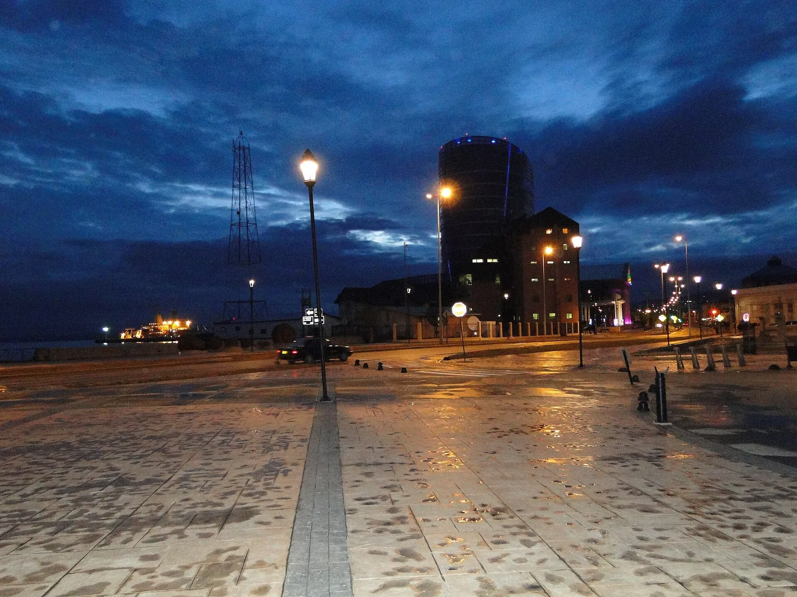
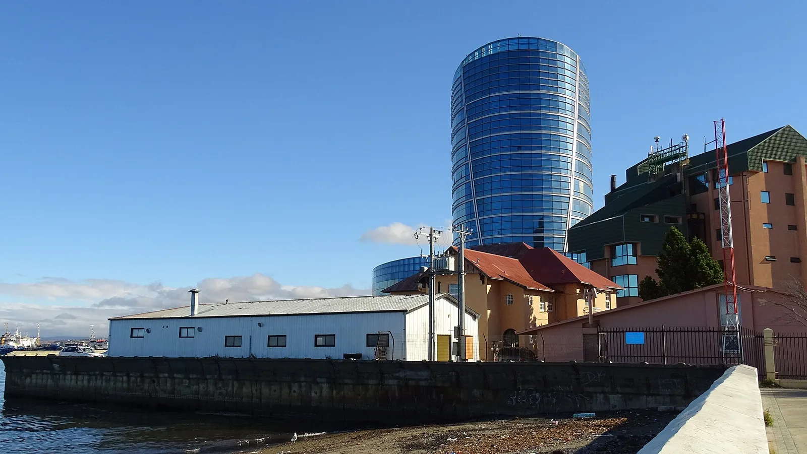
Port of Punta Arenas on the Strait of Magellan. Photo: Manuel Cañón P., CC BY-SA 3.0, via Wikimedia Commons.
Mardones and the unexpected charm of a river called Carbón
The journey north was no Sunday stroll. It meant breaking trail where there were barely animal paths, under a sky that doesn’t always help. But sometimes Patagonia offers small miracles. And one of those miracles, for Mardones, was a river.
Accounts from the time say that the governor was “enchanted” by the hills of a watercourse that was then called the Carbón River, and that we now know as the de las Minas River. It wasn’t just a poetic whim: the mouth offered something that, in the context of the strait, was pure gold… even if it wasn’t gold. There was a stepped plain descending from the mountains to the beach. There were dense forests. There was permanent water. Good pasture. And firewood. Food and fuel: the difference between scraping by and being able to imagine a future.
Imagine that group stopping their horses at the edge of the riverbank. They were coming from a dry, battered fort; suddenly they found themselves in a place that, without being a tropical oasis —we know it’s not— had what was needed to dream of something more stable. This isn’t about romanticism: it’s about logistics. An area with shelter for ships in the strait, plus forests and water within easy reach.
The name that appeared on English navigation charts was simple and literal: Sandy Point, Punta Arenosa. That’s where Mardones decided to take his chances. He laid out a road from the old fort and began to move people. Little by little, everyday life shifted toward that Brunswick Peninsula, some 60 kilometers to the north: first a few groups, then more families, until the center of gravity shifted completely.
What’s interesting is that, while the first houses were being hammered together and the first blocks were being laid out, nobody knew they were raising what would become the capital of the Región de Magallanes y de la Antártica Chilena. There were no speeches, no bronze plaques. Just tired people putting up roofs that wouldn’t blow off in the first storm.
The city that began without a charter, but with paperwork
There’s a delightful detail in the history of Punta Arenas: it is, as one author wrote, “the city that has never been founded” in the strict legal sense. There is no solemn decree saying: “On such and such day the city of… is founded.” What does exist is a date that local memory embraced as a starting point: December 18, 1848.
That day, José de los Santos Mardones sent from the new colony his first official communication. Nothing epic: just another administrative document, the kind that usually sleeps in archives. But over the years, that paper turned into a milestone. “December 18 has become the date of the founding of the city of Punta Arenas, although in the reality of historical facts, there is no official founding decree for the capital of the región de Magallanes,” says a text that studies the subject.
I love that invisible scene: a governor probably bundled up to his ears, drafting an official letter while outside the strait is howling. No marching band or assembled squadron, no ribbon cutting. And yet, a city was being born right there. Some sources speak of 1848, others of 1849 as the moment when the population began to settle more permanently. What’s certain is that by the early 1850s the name Punta Arenas was already firmly associated with that new settlement that was leaving behind its mere status as a fort.
Little by little its role also changed. It was still a control point on the strait, but it was no longer just a penal settlement isolated in the wind. In 1853 a decree changed its status from penal colony to colonization territory. Long words for a profound shift: the focus was no longer only on punishing or watching, but on populating, on attracting people, on building something lasting.
If you walk today through the historic center and look at the buildings surrounding Plaza Muñoz Gamero, it’s hard to imagine those somewhat improvised beginnings, without a pompous founding charter. But perhaps part of the character of Punta Arenas comes from there: from having been built more through paperwork, planks and everyday decisions than through grand ceremonies.
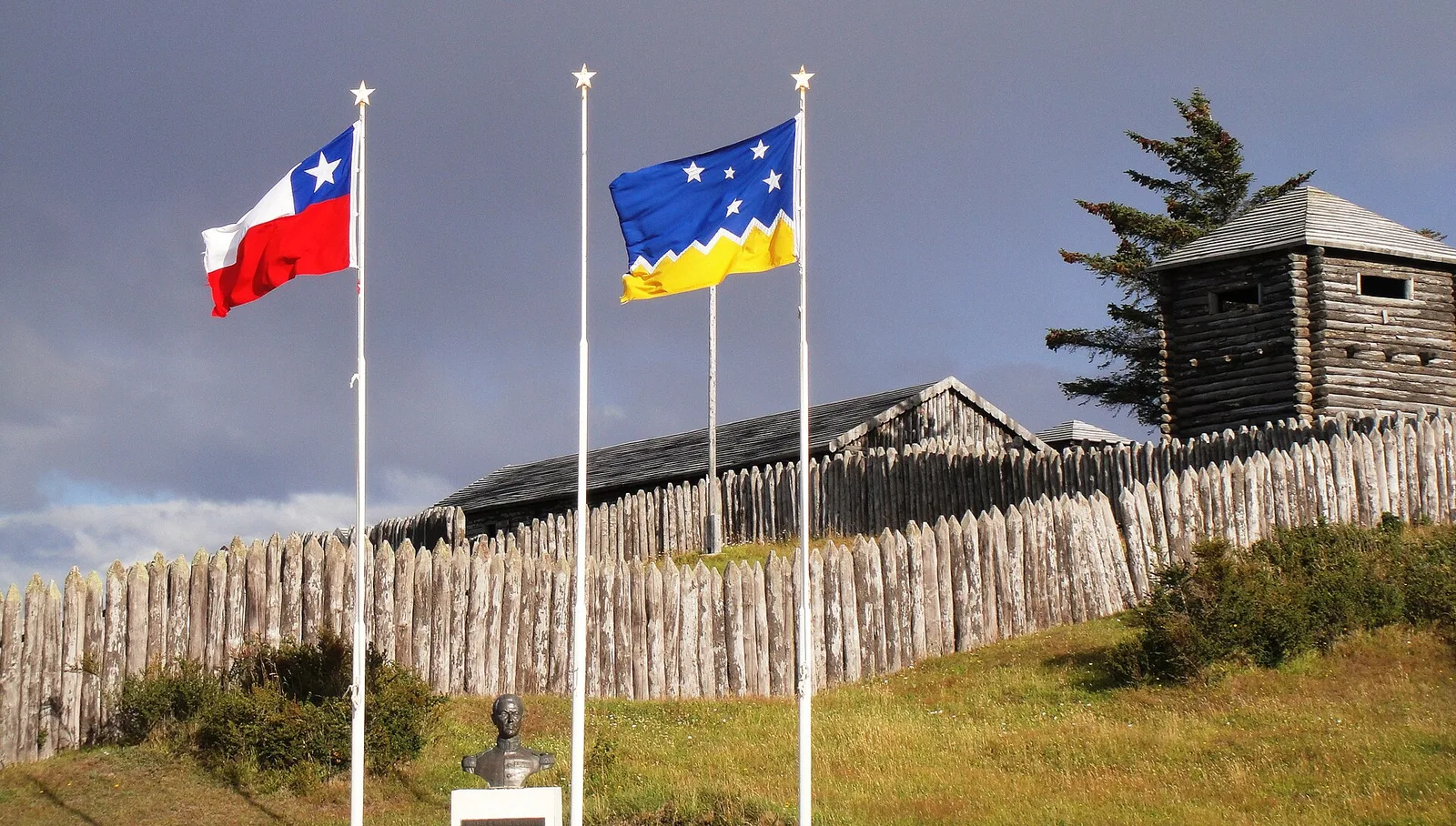
Entrance to the national monument Fuerte Bulnes, near Punta Arenas. Photo: Magallanes1, CC BY-SA 3.0, via Wikimedia Commons.
From the end of the earth to a crossroads
Toward the end of the 1860s, official documents began to catch up with what reality was already hinting at. The government of José Joaquín Pérez, for example, issued in 1868 two decrees —on July 13 and September 21— that established Punta Arenas as a Minor Port and therefore a Free Port. In plain terms: doors were being opened to trade, to the arrival of ships, to the movement of goods and people.
From then on, the colony began to see itself less as a prison and more as a port. Various historical studies show how Punta Arenas became a port of call for ships crossing the Strait of Magellan, while at the same time the sheep ranching economy in the region grew rapidly. European and Chilean settlers promoted commercial houses such as Menéndez, Wehrhahn and Wahlen, and by 1893 it was estimated that approximately one fifth of the population worked in connection with shipping companies.
Meanwhile, around the current Plaza Muñoz Gamero, the buildings that today form the Zona Típica were going up, with residences such as the Braun Menéndez palace, built by a family linked to the livestock and commercial boom of the late 19th and early 20th centuries. Much later, in 1982, that same palace would be donated to the State to house the Museo Regional de Magallanes, which tells the story of the city from the 16th century to the early 20th century.
Today, if you arrive by air at the airport or by sea on ferries and cruises that sail the channels, you enter a city that connects commerce, services, livestock, hydrocarbons and tourism; and from there you can continue on to Puerto Natales, inland estancias or parks like Torres del Paine. From there, routes depart toward Puerto Natales, toward the inland estancias and toward parks such as Torres del Paine. And logistical and tourist flights also take off from there toward Antarctica, especially to the Unión Glacier sector.
Reports on the Territorio Chileno Antártico repeat a consistent fact: the growth of the Magellanic colony, and especially of Punta Arenas, allowed for the emergence of whaling companies that operated in Antarctic seas under state authorization. Over time, the city came to be established as one of the main gateways to the white continent, especially by air.
If you look at this whole historical arc, from the wooden boards of Fuerte Bulnes to Antarctic flights, the line is not straight but it is clear: from feared frontier to southern crossroads.
What gets founded when no one is looking
I’ve always been struck by this idea that Punta Arenas doesn’t have a solemn “birth certificate,” but rather an agreed-upon date based on a simple official letter. There’s something very human in that: how many important things in our lives started that way, without trumpets, on any given afternoon, just because it was what needed to be done.
The pioneers of the far south didn’t know they were raising a future regional capital, a gateway to Chilean Patagonia, a logistics hub for scientific expeditions, tourist ships and Antarctic flights. At best, they knew they were trying to live a little better than in a wooden fort battered by the wind. And yet, decision after decision —moving the settlement, choosing a river with good pastures, opening it as a free port— they nudged history along.
Punta Arenas teaches something simple and powerful: you don’t need a decree to start something big. You just need to start, so start today because the future shows up fast and life won’t wait for you. Look for a better place, draw a path, write that first official letter even if outside the wind is really howling. Time takes care of the rest. And the people who dare.
This story will continue very soon: Sailing ships, steamers and sheep
By Diego Pastuch Cover photo: Mirek237, CC BY-SA 4.0, via Wikimedia Commons.
Share
Rate this story
No ratings yet
0 comments
No comments yet. Be the first!
You may also like
 Jules Verne and the real lighthouse at the end of the world
 Getaway to Bariloche: 3-Day Itinerary and My First Time in the Snow at 50
 Fulfilling the Dream of Traveling to Ushuaia
 Journey of the Sailboat Galileo in Patagonia and Argentine Antarctica - 2nd part -
 Journey of the Sailboat Galileo in Patagonia and Antarctica by Commander Navas
 Ushuaia, the City at the End of the World… where everything begins
 An Unsettling Experience in Victoria Island
 Jurassic Park in Southern Patagonia