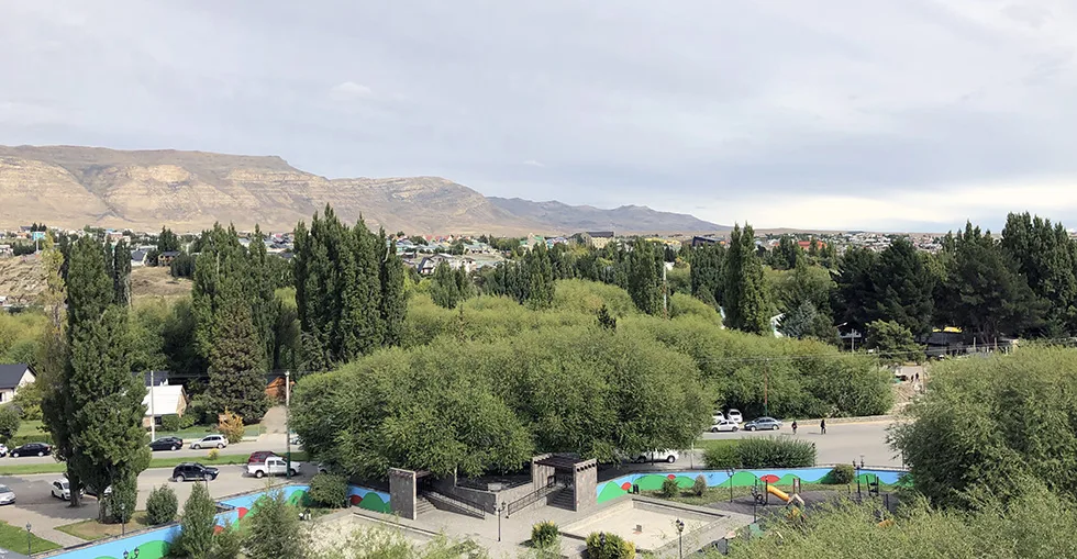
Guide to El Calafate
El Calafate was, at the beginning of the 20th century, just a place to store wool that was later transported by cart from the ranches in the region, and its original name was Kehek Aike. The founding of the original settlement took place on December 7, 1927, by the Argentine state with the purpose…
Machine translation.
We present a quick Guide to El Calafate to use as a reference for planning tourist activities in the region. It is a starting point due to its strategic location near the international airport and the proximity to the large Argentino and Viedma lakes as well as to Los Glaciares National Park and the majestic Perito Moreno Glacier.
El Calafate was, at the beginning of the 20th century, just a place to store wool that was later transported by cart from the ranches in the region, and its original name was Kehek Aike. The founding of the original settlement took place on December 7, 1927, by the Argentine state with the purpose, like other towns in Patagonia, of asserting sovereignty and populating a region that still today has an extremely low population density. However, the town really began to develop from 1943 when the National Parks Administration started construction of the management building of the Los Glaciares National Park, carrying out important infrastructure works in the following years such as roads, bridges, electrical installations, the first inn in the town, etc.
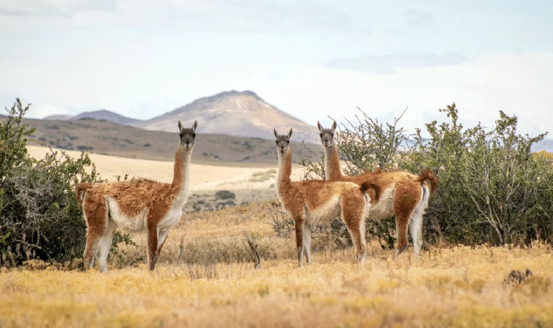
The original inhabitants, the Aonikenk indigenous people, roamed the region chasing herds of guanacos in groups of no more than 50 people; they were nomads, hunters, and gatherers who lived in caves and temporary dwellings made of guanaco skins, called tolderías. 15 km east of the city of El Calafate lies Punta Walichu, an archaeological site on the shores of Lake Argentino where rock paintings can be observed that help scientists study the way of life of this ethnic group.
Origin of the Name
El Calafate is a spiny shrub with yellow flowers and small edible blue fruits, characteristic of southern Patagonia, especially the transition zone between the steppe and the mountain range. The word is of Tehuelche origin (natives of Patagonia) and its scientific name is Berberis Microphylla.
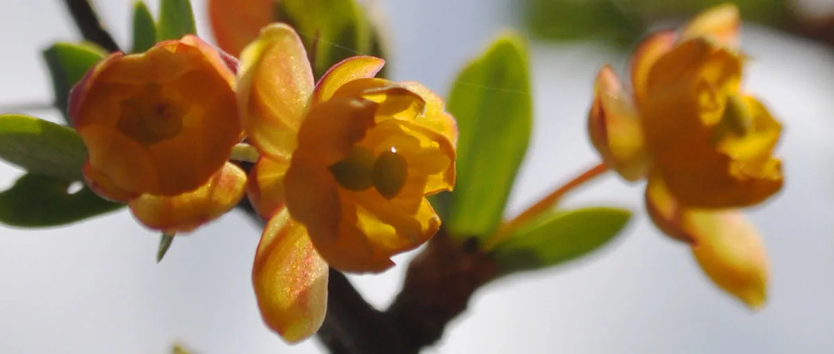
Legend has it that whoever eats calafate fruits always returns to Patagonia
The Rebel Patagonia
El Calafate was a meeting point between the ranches in the region, which also served as a stop to supply laborers and workers, as it had a hotel, a general store, and a gas station. The economic crisis triggered at the end of World War I caused the price of wool to drop, which severely affected the sheep ranches in the region and throughout the province of Santa Cruz. For this reason, ranch owners made layoffs and a widespread reduction of working conditions, leading to a series of strikes. Then the intervention of anarchist union organizations such as the Workers' Society of Río Gallegos and FORA incited workers through propaganda campaigns to unionize, followed by the intervention of paramilitary forces like the Patriotic League under the influence of the ranch owners. President Hipólito Yrigoyen sent Army troops in January 1921 to normalize the situation, but negotiations failed, leading to disturbances that turned into a general strike and the takeover of ranches, then it was ordered to end the strikes by force, resulting in between 300 and 1,500 workers being killed or executed. Source
The Climate
The climate of the city of El Calafate is cold and dry with a moderate annual temperature range. In summer, the average for the month of January is 13 °C, reaching up to 28 °C. In winter, in the month of July, the average is 1 °C with an absolute minimum temperature of -14 °C, a record reached on July 27, 2014. Precipitation is around 150 mm annually.
Growth of Tourism
Since the 1970s, tourists have started arriving to enjoy the Perito Moreno Glacier, undoubtedly one of the most outstanding natural wonders of Patagonia, which is why the city has become one of the fastest-growing towns in Argentina, with a current tourist capacity of around 7,500 beds. Thanks to the opening of the International Airport in the 2000s, the city established itself as an international destination, receiving more than 12 daily flights during peak season.
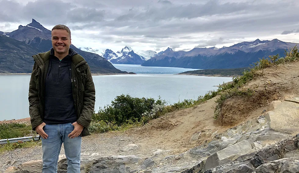
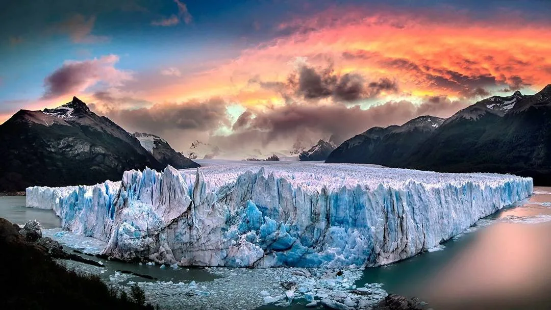
The lake and the Perito Moreno Glacier in the background within an imposing Patagonian setting
In the surroundings of Lake Argentino, a wide variety of activities are organized such as visits to tourist ranches, 4x4 excursions to the Frías and Huyliche hills, horseback riding, excursions to the ecological reserve Laguna Nimez, and walks at Lake Roca. In front of Bahía Redonda, there is the Andean Club, which was a pioneer in teaching mountain activities, open to the public with a climbing wall, a bar with views of Lake Argentino, and in winter, when the bay freezes, it offers the rental of skates and sleds.
In the National Park area, excursions to the glaciers are carried out, highlighting the Perito Moreno Glacier, with excursions such as mini-trekking on the glacier itself, navigation through the channels of Lake Argentino visiting the imposing Upsala, Spegazzini, Onelli, and Seco glaciers, among others.

Mini Trekking on the Perito Moreno Glacier
The Glaciarium Patagonian Ice Museum is a cultural and scientific center where the latest research on glaciers and their environment is disseminated.
In 2011, the glacier interpretation center was inaugurated, located 5 km west of the city. In the basement of the Glaciarium Patagonian Ice Museum is El Glacio Bar, the only one in the world made of glacier ice; in fact, everything in this bar is made of ice, including the walls and even the furniture: the glasses, the bar, and the armchairs, etc.
With an area of 80 m², it has an ambient temperature of -10 º.
Excursion Sailing the South Wall of the Glacier
It begins from El Calafate along provincial route 11, bordering Lake Argentino, after entering the Los Glaciares National Park. Along the route, you reach the Bajo de las Sombras dock located on the Magallanes Peninsula, from where a boat is taken and sailed for 20 minutes to cross to the other shore of the Brazo Rico. From the boat, a beautiful panoramic view of the Perito Moreno Glacier, the forest, and the mountain range with snow-capped peaks can be appreciated. Traveling on the deck of the boat is the best way to enjoy the landscape and nature. The navigation takes place along the south wall of the Glacier. A very good opportunity to take excellent photos.
https://www.youtube.com/watch?v=89xESqgcDUI
What to Eat in El Calafate
Patagonian lamb is a meat widely used for barbecues in Argentine Patagonia, especially in Santa Cruz and Chubut because the best lambs are raised in that area, thanks to the dry climate and sufficient rainfall. The result is a meat low in fat and cholesterol, making it very healthy, tender, and delicious. See this travel story to Calafate.
Location and How to Get There
The city of El Calafate is located 3000 km from Buenos Aires and 310 km from Río Gallegos (Capital of the Province of Santa Cruz).
From the north and along the coast, to the east of the province, it can be accessed via National Route 3, continuing along provincial routes 5 and 11, which are fully paved. Another option is to travel from the west, bordering the mountain range along National Route 40 until connecting with Provincial Route 11. To the south, El Calafate is linked to Río Turbio and the border crossings Cancha Carrera-Retén El Castillo or Mina Uno-Retén Dorotea, which connect it to Torres del Paine in Chile, via Route No. 40. The city has regular passenger transport services to and from Río Gallegos, El Chaltén, and Chile. The city has public transport managed by the municipality.
How to Get to El Calafate by Car
From Buenos Aires via National Route 3 (Atlantic Coast), the journey is made on paved roads, covering a distance of approximately 3000 km. From the city of Buenos Aires, you must take National Route 3, crossing the province of Buenos Aires until reaching the city of Bahía Blanca. From there, continue along Route 3, bordering the Atlantic coast and entering the Patagonian steppe. After Viedma, the distances between urban centers increase, and road services decrease. Then you reach the town of Sierra Grande and the Valdés Peninsula and the city of Puerto Madryn. From there, continue south passing through the city of Trelew and later Comodoro Rivadavia and Caleta Olivia. Entering the province of Santa Cruz, you arrive at Comandante Luis Piedra Buena, and later you reach Río Gallegos. From Río Gallegos, you must take Provincial Route No. 5, National Route No. 40, and finally, Provincial Route No. 11.
From Bariloche or Esquel via National Route 40 (parallel to the Andes Mountains)
You must take National Route 40 south, passing through the towns of Gobernador Costa and Los Antiguos.
Route 40 is not always passable; necessary precautions should be taken, and the road conditions should be checked at the time of travel.
How to Get There by Bus
From Buenos Aires, there are different companies that make the trip of approximately 37 hours. Some of the companies are Andesmar, Don Otto, and El Pingüino. From Río Gallegos, there are several daily frequencies, and the trip takes 4 hours.
From southern Chile (Puerto Natales and Punta Arenas), there is one or two daily frequencies depending on the season.
Traveling to Calafate by Air
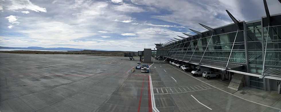
The runway of the modern El Calafate Airport
The city has the modern El Calafate International Airport (IATA code: FTE), located just 23 km east of the urban center near RP 11, with daily flights to Buenos Aires, Ushuaia, Trelew, Puerto Madryn, Bariloche, Río Gallegos, Rosario, Córdoba, and Puerto Natales.
Approximate flight times
Buenos Aires – Calafate: 3 hrs
Bariloche – Calafate: 1.45 hrs
Trelew – Calafate: 1.50 hrs
Ushuaia – Calafate: 1.10 hrs
Site of El Calafate Tourism
Share
Rate this story
No ratings yet
0 comments
No comments yet. Be the first!
You may also like
 10 Days in Patagonia: The Ultimate Itinerary for Argentina & Chile
 Route 40 in Patagonia: The Complete Road Trip Guide (Road Conditions, Stops & Best Time to Go)
 Route of the 7 Lakes: Now the Walk of the 9 Lakes (Complete 2026 Guide)
 Destination Bariloche: Your Incredible Journey Starts Here!
 The Routes of Northwest Santa Cruz Offer a Journey Within
 Puerto Madryn the Capital of Diving and Nautical Tourism in Argentina
 San Martín de los Andes - Tourism and Adventure in the Heart of the Andes
 When is the Best Time to Visit Patagonia?